A Treasure in Your Backyard
Exploring the bounties of the Battenkill Valley Forest
The Conservation Fund, in partnership with the Vermont Department of Forests, Parks and Recreation is exploring conservation solutions for the 2,700-acre Battenkill Valley Forest parcel in Sandgate and Rupert. If it becomes a new State Forest, the conservation project will:
- Create public access, on land that is currently posted
- Come at no cost to towns of Sandgate and Rupert
- Protect significant archaeological and historical resources
- Conserve important ecological features, natural communities, and water bodies
- Continue to support the local, working forest economy
Scroll down to learn more about the wonders of the Battenkill Valley Forest site.
Ballad of the Battenkill
Dense groves of old oaks, ragged mountain peaks as far as the eye can see, and a dozen cellar holes clustered in the woods that date back to the 1700s . . .
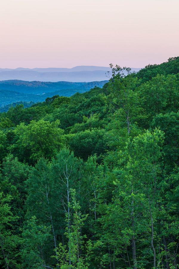
This may seem like the start of an adventure story set deep in the woods, but it's not make-believe. The Battenkill Valley Forest, located in Sandgate and Rupert, Vermont, hosts all these features and more. Hidden in the heart of the Taconic Mountains, on the border of Vermont and New York, this 2700-acre tract of land is home to several mountain summits, oak forests, rare plant species, wetlands, streams, and more. The site also contains remnants of historic settlements from the 1700s and 1800s, which are believed to be connected to Daniel Shays, the leader of Shays' Rebellion.
This incredible site is currently being held in a trust by The Conservation Foundation (TCF). TCF is working with local partners, the State of Vermont, and other organizations to protect the valuable natural and historic communities on this site for a long time to come.
The Battenkill Valley Forest is located in southwestern Vermont, in the heart of the Taconic Mountains.
Nature's Bounty
Peaks and Valleys
The Battenkill Valley Forest is a mountainous area home to a variety of peaks, including Egg Mountain (2,487 feet, marked in orange), Bald Mountain (1,942 feet, in pink), and The Big Ridge (1,370 feet, in blue). These steep, forested slopes support the diverse ecosystems in the area.
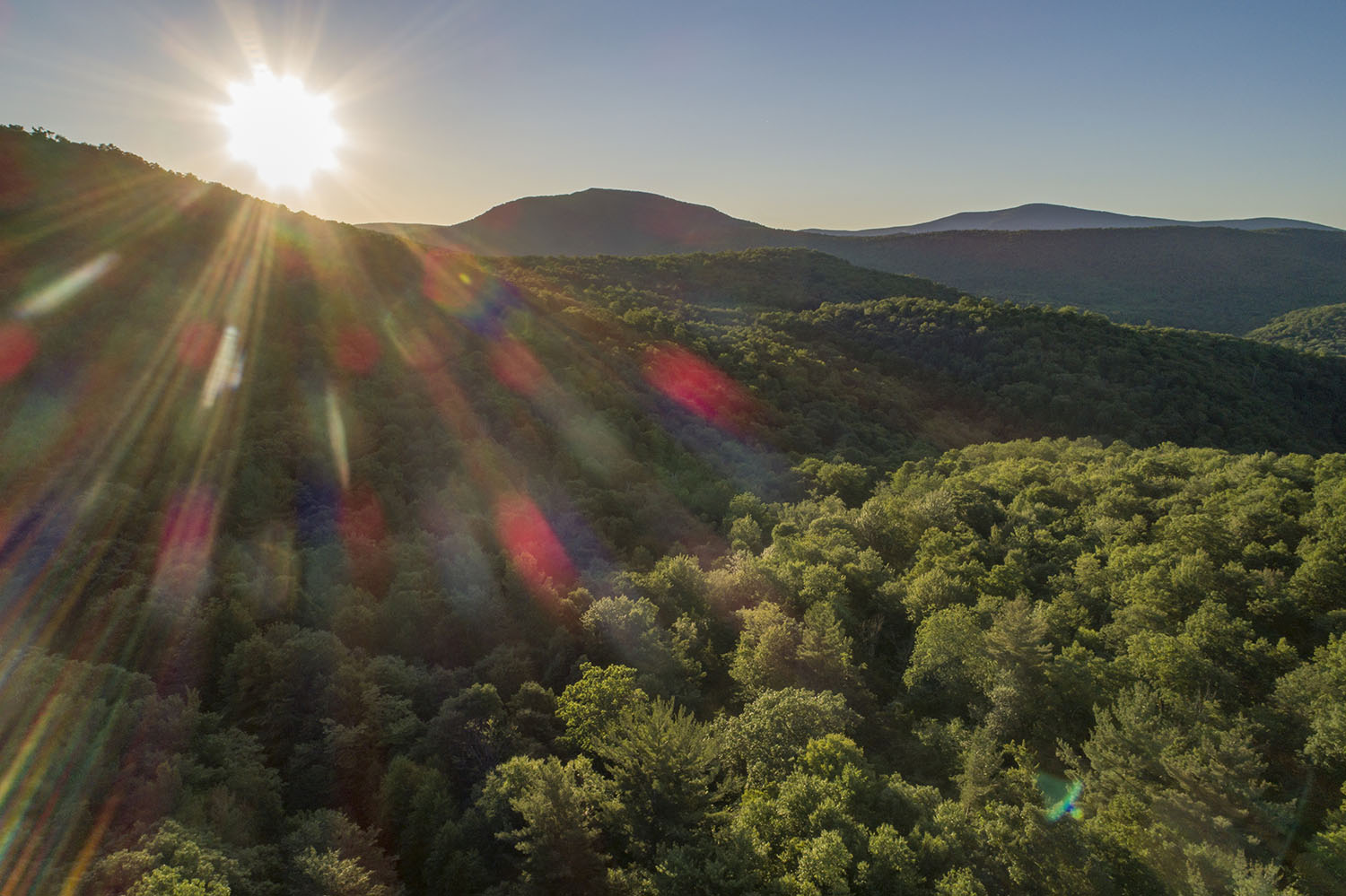
The sun shines down on the rolling hills and mountains of the Battenkill Valley Forest.
Connectivity and Resilience
The tract of land is also important within the broader context of Vermont's ecological function. The Battenkill Valley Forest forms the majority of a Highest Priority Forest Block and a Priority Connectivity Block in assessments by Vermont Conservation Design. This means that the contiguous forestland is especially important and provides critical connections between biophysical regions.
The site is recognized by The Nature Conservancy for its biodiversity, climate resilience, and ecological connections that can support the movement and adaptation of species to climate change. It appears in the Resilient and Connected Network , which identifies the best places in North America to protect biodiversity in a changing climate.
The Battenkill Valley Forest's mountainous terrain contributes to its robust ecosystems. Red areas on this map indicate slopes greater than or equal to 51%. For reference, extra steep roads are usually about 8-12% grade.
An Oak Wonderland
One of the most important natural features of the Battenkill Valley Forest are the rare forest types on the property. The south-facing slopes and soils support warmer climate species such as hickory and oak, and the entire property contains 23 very rare to uncommon plants.
The most ecologically noteworthy forests on the property are about 230 acres of oak forests that are considered State Significant, as they contain state-endangered plants, other rare and uncommon plant species, and are also habitat types rare to the state of Vermont. Many of the trees in these unique oak forests, scientifically known as the Dry Chestnut Oak Woodland, are stunted due to the harsh growing conditions, creating an open ‘elfin woodland’ feel with mature trees only 20-30 feet tall.
Over the River and Through the Woods
There are several wetland natural community types present in the Battenkill Valley Forest. Although the footprint of wetlands on the property is small, they play an outsized role in supporting the area’s robust biodiversity.
An adult brown trout, which calls the brooks and rivers of the Battenkill home.
The area also contains 11.5 miles of headwater tributaries of the Battenkill. All of this water ends up in the Battenkill, which flows into the Hudson River.
The Batten Kill Basin knows no boundaries! Streams from this part of the forest flow into New York and eventually into the Hudson River.
A Walk Back in Time
Layers of History
Within the 2700-acre tract of the Battenkill Valley Forest, there is a network of historic settlements that date back more than 200 years. A 93-acre in-holding site is now owned and cared for by The Archaeological Conservancy , who is working to learn more about the forest's past.
The archaeological remains were primarily found in the southern part of the forest.
Behind the scenes: Students from Stephen Butz's class used iPads to capture 360-degree images of the site.
360 image: Shays' Settlement Project - Stephen D. Butz
Cellar Holes
The archaeological sites include more than a dozen cellar holes, as well as stone walls and dams that indicate human settlement back to the 1700s. Archaeological research and historical documents suggest the settlement was founded in 1787 and was abandoned between 1814 and 1822.
Ceramics found in Foundation 5 (Photo: Shays' Settlement Project - Stephen D. Butz)
The settlement is also believed to have included "a tavern, a little store, a school and about 15 to 18 houses clustered around a village green," according to Steve Butz, PhD candidate at the University at Albany.
Students from Stephen Butz's class processing artifacts found on site.
A Time Capsule
Kelley Berliner, from The Archaeological Conservancy , says that while Vermont is home to other archaeological settlements, this site is unique for its high level of preservation, and it is certainly eligible for the National Register of Historic Places.
Artifacts recovered from the site include a wide range of ceramics, eating utensils, window glass, pipes, buttons and sewing needles, jewelry, and iron artifacts.
An assortment of items found near the Mill site (Photo: Shays' Settlement Project - Stephen D. Butz)
An assortment of items found near Foundation 5
360 image: Shays' Settlement Project - Stephen D. Butz
The Legacy of Daniel Shays
It is thought that Daniel Shays might have lived at this settlement after his namesake rebellion in Springfield, Massachusetts in 1786. Shays, a distinguished Revolutionary War veteran, was one of a group of farmers who organized an attack on the Springfield Armory. The rebels were protesting what they viewed as excessive taxation and exploitative debt collection practices in Massachusetts in the economically challenging years following the Revolutionary War. After the unsuccessful rebellion, Shays and fellow rebels fled to Vermont, where they are known to have settled near Arlington. This site's association with Daniel Shays, whose actions motivated the adoption of the Constitution and the Bill of Rights, is only one part of what makes it an important historic resource in the state. Independent from the possible connection to Shays, the site is very significant because of its highly intact archaeological deposits, its short period of use that offers researchers a clearer "snapshot" from this time period, and what it can tell us about a community that lived in Vermont prior to and during its efforts to become a state.
Daniel Shays and Job Shattuck, 1787. National Portrait Gallery, Smithsonian Institution
360 image: Shays' Settlement Project - Stephen D. Butz
Opportunities Today
The Battenkill Valley Forest is not just a historic site. The forest plays host to important recreational and forest management activities today.
Because of the forest's highly productive soils, the area offers quality timber management opportunities, with the last harvest in 2018. The primary forest types harvested from this site include maple and red oak.
The Battenkill Valley Forest has historically provided a productive site for sustainable forest management. The timber resources on the property are an important consideration in determining future management of the land.
The forest is currently part of a private hunt club license, which does not allow public access for recreation.
There are no recreational trails in the forest as of yet, but there are a number of well maintained truck roads. These 7 miles of woods roads present an opportunity for further recreation by walkers and hikers in future seasons.
The Battenkill is also a popular destination for fly-fishing. In fact, the Battenkill was the first designated Outstanding Water Resource in the State of Vermont. Protecting the headwater forests and streams within the Battenkill Valley Forest will also protect the fishing and hunting opportunities of the area.
From left to right: A successful Sandgate Youth Weekend, fall 2022; cross-country skiers in nearby Fayville, Glastenbury; exploring Egg Mountain.
Planning for Tomorrow
Since 2017, the Battenkill Valley Forest property has been held by The Conservation Fund, a non-profit that helps find long-term conservation solutions for naturally and culturally significant properties. The Conservation Fund is trying to find a permanent owner for this site and responsible manager of the land. The Battenkill Valley Forest property contains so many important qualities: unique and rare plants and tree communities, nationally significant historic resources, forest resources, headwater streams, and opportunities for new public access. Finding the ‘right fit’ to conserve and manage the land is a slow and deliberate process.
TCF is partnering with the State of Vermont to explore potential conservation outcomes. One possible outcome is to protect the land as a new State Forest. In this scenario, the property would be owned and managed by the State of Vermont Department of Forests, Parks and Recreation. The establishment of a new State Forest would:
- ensure the conservation of significant natural communities
- protect historic resources through the Vermont Division for Historic Preservation
- ensure timber harvest is allowed to continue in a sustainable manner when and where it is appropriate
- provide permanent public access for hunting, fishing, pedestrian access and other forms of dispersed recreation.
This important forestland parcel would remain forested in perpetuity, bringing with it all of the associated benefits of forest land, such as wildlife habitat, water quality protection, and climate resilience.
Sandgate's Town Hall
If the Battenkill Valley Forest site did become a new State Forest, the Department of Forests, Parks, and Recreation would develop a Long-Range Management Plan with public involvement and local input, and the forest would be managed through the Rutland District Office.
The State of Vermont would make a payment in lieu of taxes (PILOT) to Sandgate and Rupert that is designed to compensate towns for the amount of revenue lost in taxes as a result of state ownership. The PILOT will be equivalent to what the Towns would have received were the property to have remained in private ownership, for the years immediately following the State’s acquisition.
Rupert's Town Office
Alternative forms of conservation could result in no public access, loss of tax revenue, damage or loss of significant preservation of historic sites and resources, no local input on management, or elimination of timber harvesting—depending on the objectives of the owner.
This is where you come in!
Talk to your neighbors and friends about the site. If you agree that the Battenkill Valley Forest is worth protecting, let us know. Contact your local elected officials to let them know your thoughts on conserving the Battenkill Valley Forest. Reach out to The Department of Forests, Parks and Recreation with questions or to share your input.


