Farmers Protect Waterways Using Mapping App
By Jessica Wyland
A mapping app is helping New Zealand face an “economy versus environment” dilemma. The island nation, home to nearly 5 million people, relies heavily on dairy exports, yet needs to mitigate the potential effect of dairy farms on the waterways.
Fences around rivers and streams prevent cows from accessing waterways and potentially impacting water quality. Strategic plant buffers near waterways, known as riparian zones, can capture run-off from dairy farms before it drains into waterways.

Just like everyone else, farmers want sustainability. Last year they enlisted a mapping app to identify waterways on farmland for more effective mitigation efforts. Farmer-owned dairy nutrition company Fonterra hired GPS-it, a New Zealand-based land mapping solutions company, to build the app. They built it using AppStudio for ArcGIS, a tool that lets you convert maps into consumer-friendly mobile apps ready for Android, iOS, Windows, Mac OS, and Linux.
“Nothing beats putting a map in front of someone,” said Matt Flowerday, founder of GPS-it. “We can say, ‘this is your farm and here are the waterways.’ It’s a fantastic education tool.”
Q: Tell us about the app you built.
A: We built an app to help improve the sustainability of New Zealand dairy farms. We needed to run it on multiple devices and it had to support three projects—waterway protection, nutrient management, and riparian planting on farms. We used AppStudio for ArcGIS, a tool that converts maps into consumer-friendly mobile apps ready for Android, iOS, Windows, Mac OS X, and Linux. The cross-platform functionality appealed to us. We liked that we could customize completely without having to worry about iOS, Android, or Windows. The code generates automatically for each device. We use Portal for ArcGIS to determine which people see which data.
Q: How does Fonterra use the app?
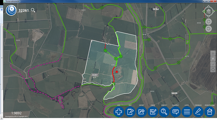
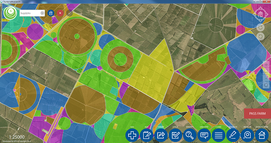
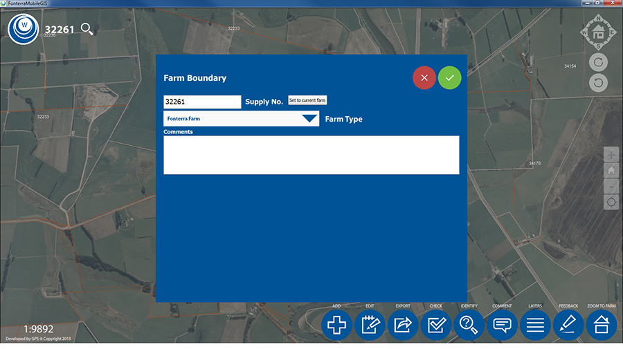
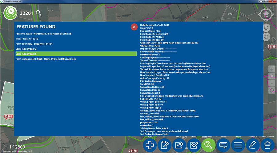
A: Fonterra’s sustainable dairy advisors get about 30 minutes of training using a training demo that’s built into the app. Each time they visit a farmer, they use the app to draw management blocks on the farm and create buffer zones around waterways. They can generate a report about soil types and properties on the farm, then provide a plan for nutrient management, riparian planting, and fencing around waterways.
A: The imagery basemaps, when online, draw from an imagery service hosted in ArcGIS online. Offline, they come from tile packages cut from the same source. Some of the vector data, such as titles and waterways, was originally sourced from Land Information New Zealand and has been updated and improved upon over several years. Fonterra provided farm location data. Other data layers, such as crossings, were created from scratch and from data collected by users of the app.
Q: How did you get data into the app?
A: The data is hosted on an Amazon server running ArcGIS Server. Offline geodatabases are generated on the fly onto the devices. The offline basemaps are sideloaded.
A: The actual AppStudio app took approximately four months to design and build. The workflow, schema and existing data was largely already in place from a previous app we built using ArcGIS for Windows Mobile. Since the app is needed on both iOS and Windows devices, we would have doubled the development time if we hadn’t used AppStudio.
Q: Did AppStudio help you build on existing work?
A: The move to AppStudio coincided with Fonterra’s migration to a new Amazon server which required a major rebuild of maps, services, and associated reports and scripts. The value of the existing work was in the datasets and workflows built up. AppStudio allowed us to expand on this and create app tools for the users. This included basic runtime geometry capabilities, such as clipping and handling multipart features, and the ability to build custom tools that created custom shapes such as the round pivot and wedge tool.
A: Response so far from field staff, farmers, and regulators has been positive. They love it. We have had really good feedback and local government agencies are liking it too.
AppStudio for ArcGIS allows users to publish apps with their own brand to all popular app stores—no developer skills required. With AppStudio for ArcGIS, organizations on the ArcGIS platform now have the ability to build cross-platform native apps, in a snap. Find out more.
insider